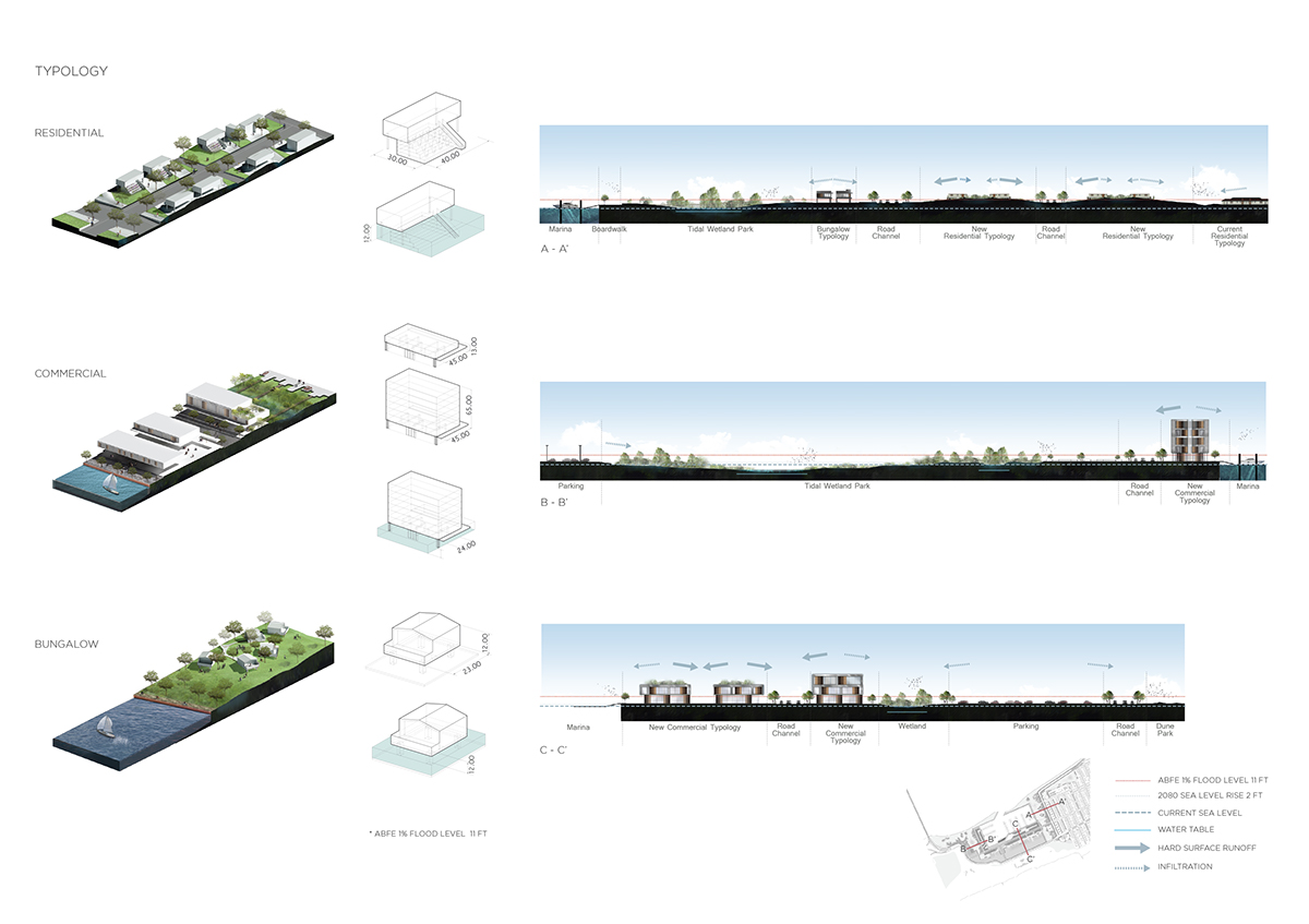


Existing topography helps us better understanding site condition regarding vulnerability of flooding event and storm hazard. By calculating data on ArcGIS, surface water direction and accumulation reveal area at low elevation, where would be considered the most vulnerable places. The result of calculation has been used as guideline while we moving into design phase.


